“Multi-million dollar development decisions are driven by as little as a $10,000 investment in high-quality, detailed mapping data making it one of the smartest investments a municipality can make for long-term growth and prosperity.”
-Jonathan Schmidt, RPP, Owner Bluerock Planning
THE WOW FACTOR DETAILS
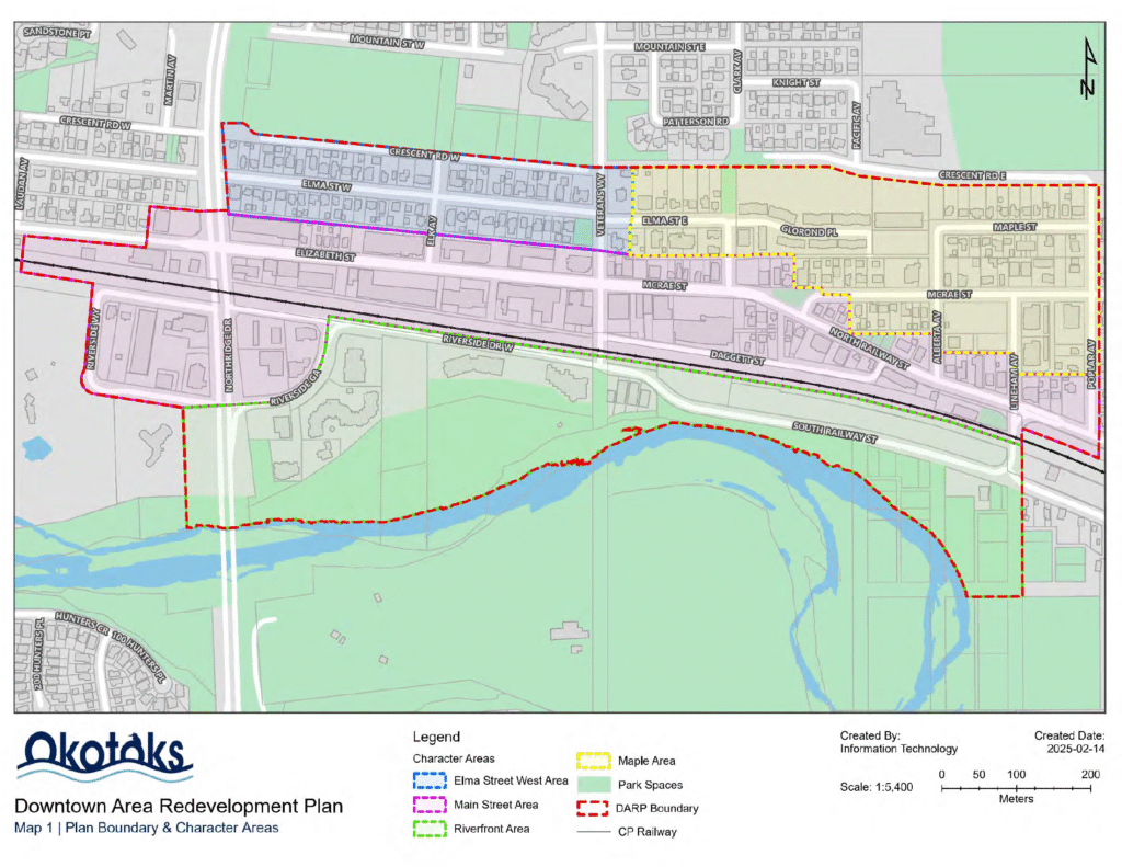
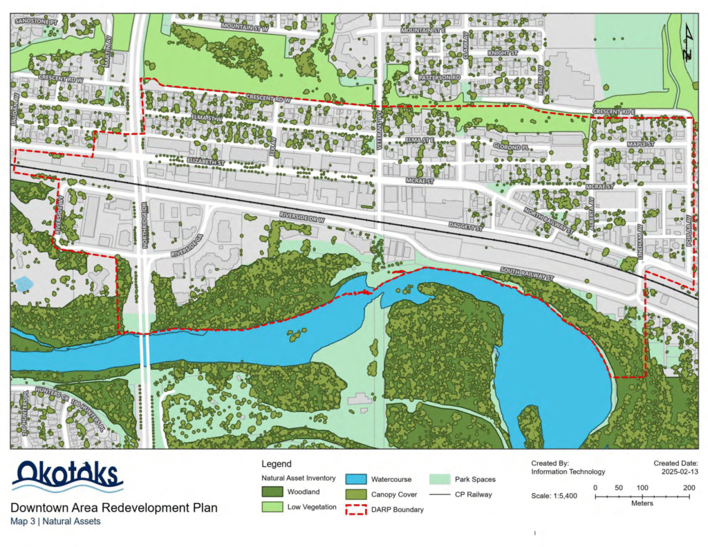
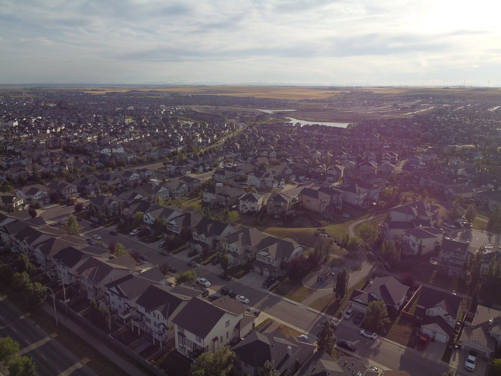
Plan Smart helps municipalities across Canada unlock the full potential of their regions by providing cutting-edge mapping solutions that support informed decision-making and drive investment. Our mapping services enable municipalities to showcase key information directly on their websites, making it easily accessible for developers, businesses, and other stakeholders. This access to information helps make investment, planning and other important decisions easy for the end user.
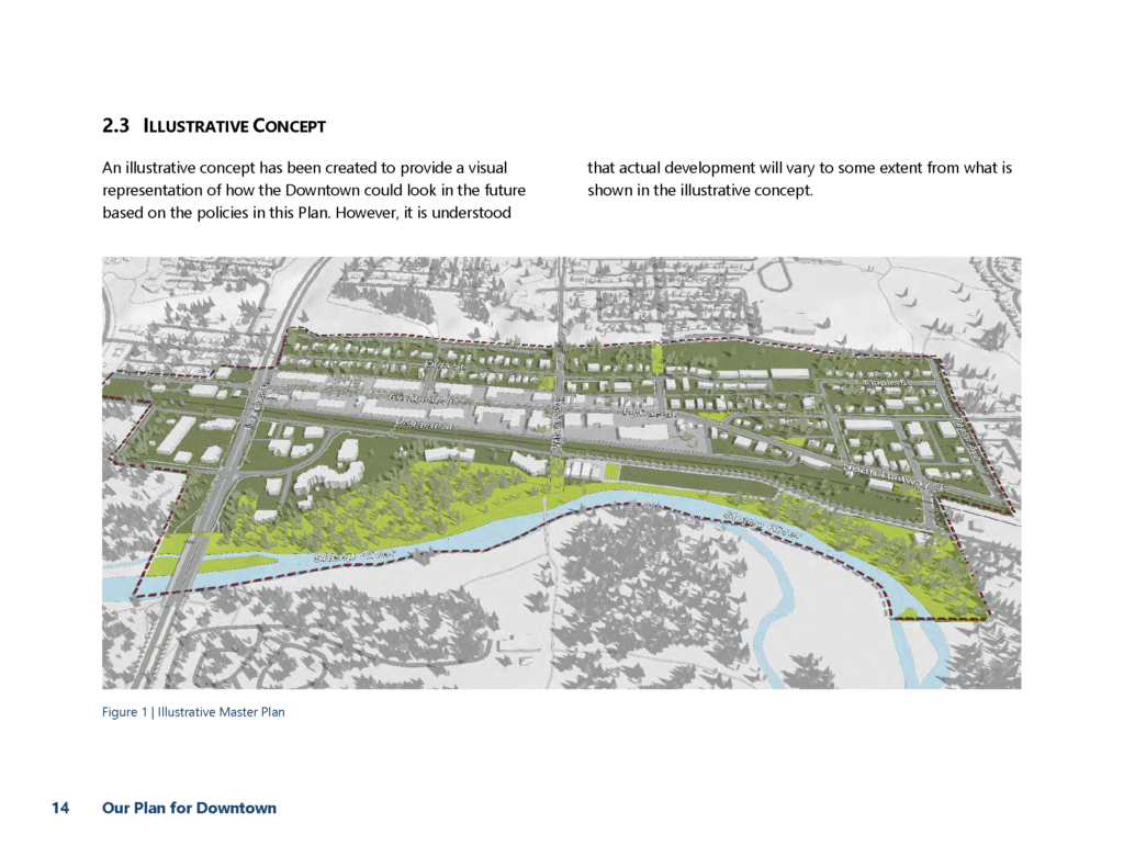
Our approach goes beyond traditional 2D maps. We also specialize in advanced 3D imaging of buildings and regions, offering municipalities the ability to visualize urban planning and development with remarkable clarity. This technology provides a more dynamic view of how areas will evolve over time, helping both local governments and developers make more informed choices. Additionally, we employ sophisticated drone mapping techniques to capture high-resolution, real-time aerial data. These modern tools allow municipalities to monitor, plan, and manage their spaces with unparalleled precision, ensuring that they can attract investment, manage growth, and plan sustainability for the best possible future.